Editor’s note (February 1, 2022): Recordings from the 2022 American Meteorological Society (AMS) Annual Meeting are available by logging in to the online meeting platform.
 With the 2022 American Meteorological Society (AMS) Annual Meeting now proceeding virtually, we want to make it easy for you to find ARM-relevant science during the meeting.
Below is a list of ARM-related AMS meeting highlights (all times Central; AMS login might be required to view abstract pages). Follow us on Twitter (@armnewsteam) for a real-time guide to relevant activities using the hashtag #ARMAMS.
Go here to find more ARM-related presentations and posters, as well as sessions, talks, and posters related to Atmospheric System Research (ASR).
Add your presentation here to be featured on the ARM or ASR presentation web pages.
Click Below to View:
Invited Presentations
Please note: Most presentations are scheduled to run for 15 minutes. The full session times are listed below for planning purposes.
- 10A.2: The Seasonal Contrast of Aerosols That Can Seed Ice Formation in Central Arctic Clouds. Jessie Creamean, Colorado State University.
Wednesday, January 26, 10:45 a.m.–noon
- 10A.5: Insights on Sources and Formation Mechanisms of Central Arctic Supercooled Clouds. Israel Silber, Pennsylvania State University.
Wednesday, January 26, 10:45 a.m.–noon
- 13A.1: Enhancing Aerosol Predictions on the Global Scale With Particle-Resolved Modeling and Machine Learning. Nicole Riemer, University of Illinois at Urbana-Champaign.
Thursday, January 27, 8:30–10 a.m.
Featured Field Campaign Presentations
TRacking Aerosol Convection interactions Experiment (TRACER)
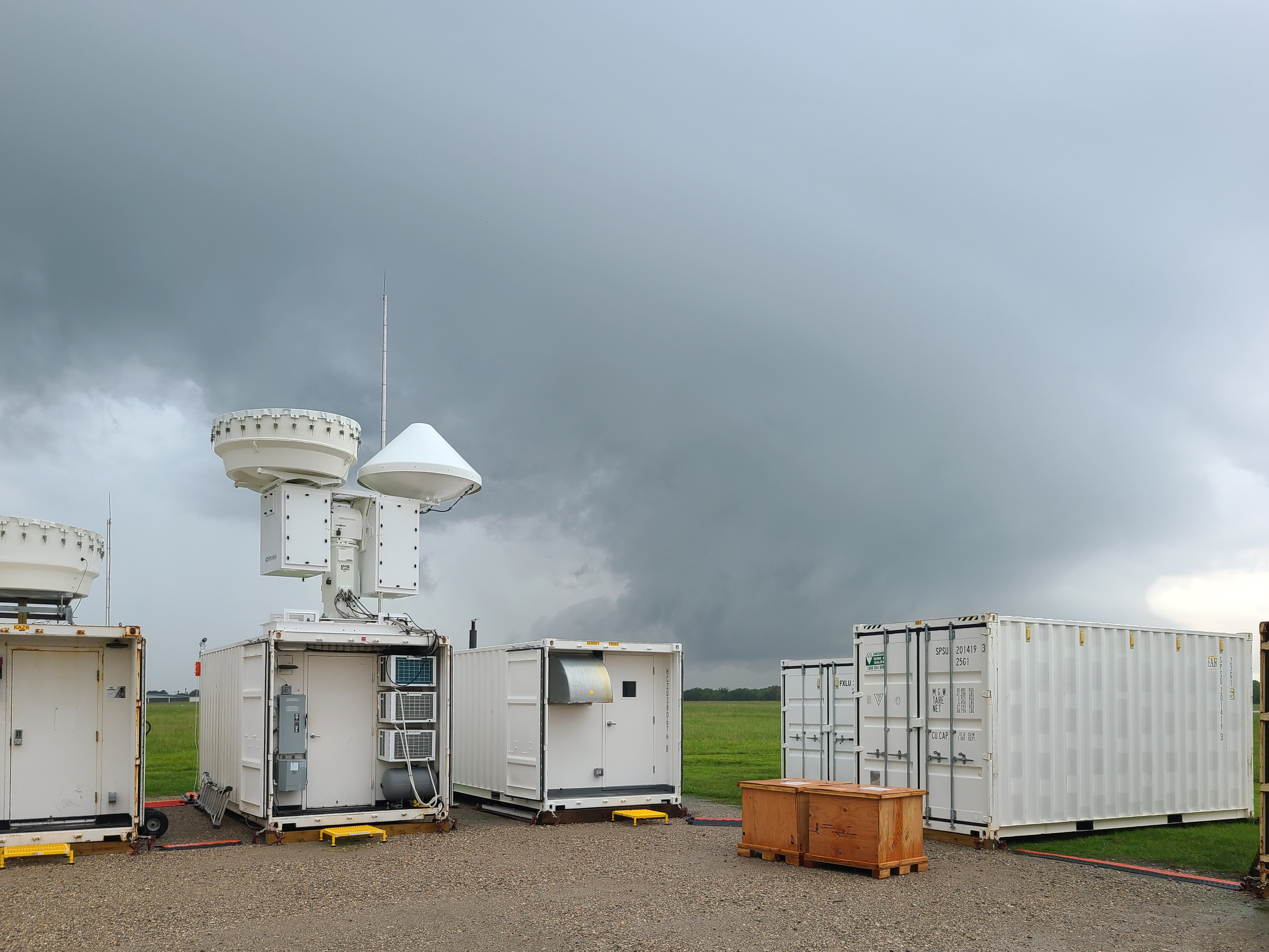
From October 2021 to September 2022, scientists will use the first ARM Mobile Facility, the second-generation C-Band Scanning ARM Precipitation Radar, and a small satellite (ancillary) site with radiosonde and aerosol measurements to learn more about cloud and aerosol interactions in the deep convection over the Houston, Texas, area as part of TRACER. The Houston region offers a unique environment where isolated convective systems are common, and it experiences a spectrum of polluted aerosol conditions from urban and industrial areas. In addition, surrounding areas also show significantly lower background aerosol concentrations.
- ORAL SESSION—1ii: Addressing Air Quality Challenges at Urban-Land-Water Interfaces During Recent Field Studies. Part I.
Conveners include TRACER-AQ Co-Principal Investigators John Sullivan and Laura Judd
Monday, January 24, 9:15–10 a.m.
Related ARM news coverage:
- ORAL SESSION—2: Addressing Air Quality Challenges at Urban-Land-Water Interfaces During Recent Field Studies. Part II.
Conveners include TRACER-AQ Co-Principal Investigators John Sullivan and Laura Judd
Monday, January 24, 10:45 a.m.–noon
- ORAL SESSION—3: Addressing Air Quality Challenges at Urban-Land-Water Interfaces during Recent Field Studies. Part III.
Conveners include TRACER-AQ Co-Principal Investigator John Sullivan
Monday, January 24, 1:30–3 p.m.
Related TRACER presentation:- 3.6: Overview of the Pandora Deployment and Analysis of Spatial NO2 Gradients During TRACER-AQ. Alexander E. Kotsakis. NASA Goddard Space Flight Center.
- POSTER—97: How Meteorological Events Affected Houston’s Air Quality During TRACER-AQ. Amber Nicole Schlessiger, NASA.
Monday, January 24, 5–6:30 p.m.
- ORAL SESSION—5B: Regional Air Quality. Part V.
Tuesday, January 25, 8:30–10 a.m.
Related TRACER presentation:- 5B.4: Observation of O3 Events with LMOL During the TRACER-AQ Campaign . Guillaume Gronoff, Science Systems and Applications, Inc.
- ORAL SESSION—6B: Aerosol–Cloud Interactions in Deep Convective Clouds. Part III.
Conveners include TRACER Principal Investigator Michael P. Jensen
Tuesday, January 25, 10:45 a.m.–noon
Reported ARM TRACER presentations:- 6B.2: Linking Synoptic Patterns to Cloud Properties and Local Circulations Over the TRACER Domain in Houston, Texas. Dié Wang, Brookhaven National Laboratory.
- 6B.3: Summary of First Light Observations From the TRacking Aerosol Convection interactions Experiment (TRACER). Michael P. Jensen, Brookhaven National Laboratory.
- ORAL SESSION—7B: Aerosol–Cloud Interactions in Deep Convective Clouds. Part I.
Conveners include TRACER Principal Investigator Michael P. Jensen
Tuesday, January 25, 1:30–3 p.m.
- ORAL SESSION—8B: Aerosol–Cloud Interactions in Deep Convective Clouds. Part II.
Conveners include TRACER Principal Investigator Michael P. Jensen
Tuesday, January 25, 3:45–5 p.m.
- PANEL DISCUSSION— 11A: Clouds, Aerosol, and Air Quality in the Coastal Urban Environment: Interagency Field Campaigns in the Houston, Texas, Region during 2021–2022.
Discussion will cover TRACER and related field campaigns
Wednesday, January 26, 1:30–3 p.m.
Cloud, Aerosol, and Complex Terrain Interactions (CACTI)
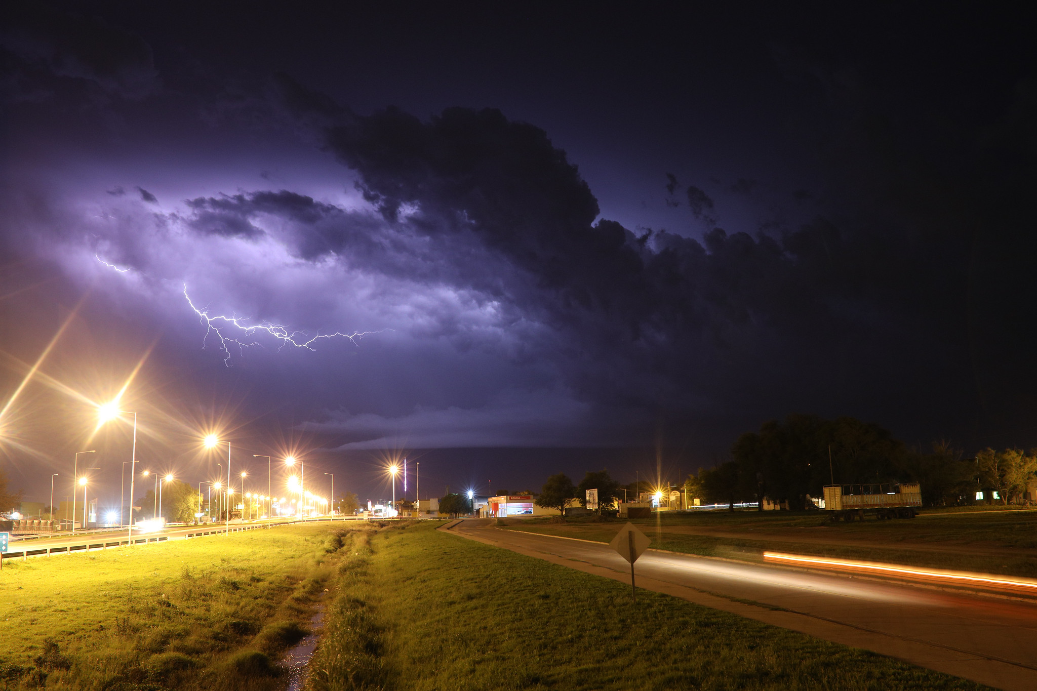
From October 2018 through April 2019, CACTI collected ground and aerial data to explore the life cycles of convective clouds in Argentina’s Sierras de Córdoba mountain range. This area is said to spawn the biggest thunderstorms in the world. The campaign featured the first deployment of the second-generation C-Band Scanning ARM Precipitation Radar, which delivers slice-like flat images of the atmosphere. CACTI ran concurrently with Remote sensing of Electrification, Lightning, And Mesoscale/microscale Processes with Adaptive Ground Observations (RELAMPAGO), a campaign largely funded by the National Science Foundation.
- ORAL SESSION—4A: Aerosol–Cloud Interactions in Warm Clouds. Part IV.
Monday, January 24, 3:45–5 p.m.
Related CACTI presentation:- 4A.1: Cloud Droplet Clustering and Cloud Droplet Spectral Broadening in Turbulent Clouds Observed During HI-SCALE and CACTI. Yayun Qiao, University of Oklahoma.
- POSTER—146: Environments Supporting Deep Convection Initiation During the CACTI Campaign. James Marquis, Pacific Northwest National Laboratory.
Monday, January 24, 5–6:30 p.m.
- POSTER—345: Estimation and Meteorological Analysis of CCN During RELAMPAGO-CACTI in Córdoba, Argentina. William Louis Faletti, Northern Illinois University.
Tuesday, January 25, 5–6:30 p.m.
- ORAL SESSION—11: Radar Observations of Deep Convection Around the World.
Wednesday, January 26, 1:30–3 p.m.
Related CACTI presentation:- 11.3: C-Band Polarimetric-Hail Detection in Subtropical South America Using Synthetic Radar Data and RELAMPAGO-CACTI Observations. Lina Esther Rivelli-Zea, University of Illinois at Urbana-Champaign.
- POSTER—513: Agricultural Sources of Ice-Nucleating Particles in Argentina During the DOE-ARM Cloud, Aerosol, and Complex Terrain Interactions (CACTI) Experiment. Baptiste Testa, ETH Zurich.
Wednesday, January 26, 5–6:30 p.m.
- ORAL SESSION—14: Mesoscale Convective Systems.
Thursday, January 27, 10:45 a.m.–noon
Related CACTI presentation:- 14.2: Observations of the Discrete Propagation of a Mesoscale Convective System During RELAMPAGO-CACTI. Kelly Lombardo, Pennsylvania State University.
- ORAL SESSION—16: Mesoscale Processes Near Orography
Thursday, January 27, 3:45–5 p.m.
Reported ARM CACTI presentation:- 16.2: Characteristics and Environmental Controls of the Convective Cell Evolution During CACTI. Adam Varble, Pacific Northwest National Laboratory.